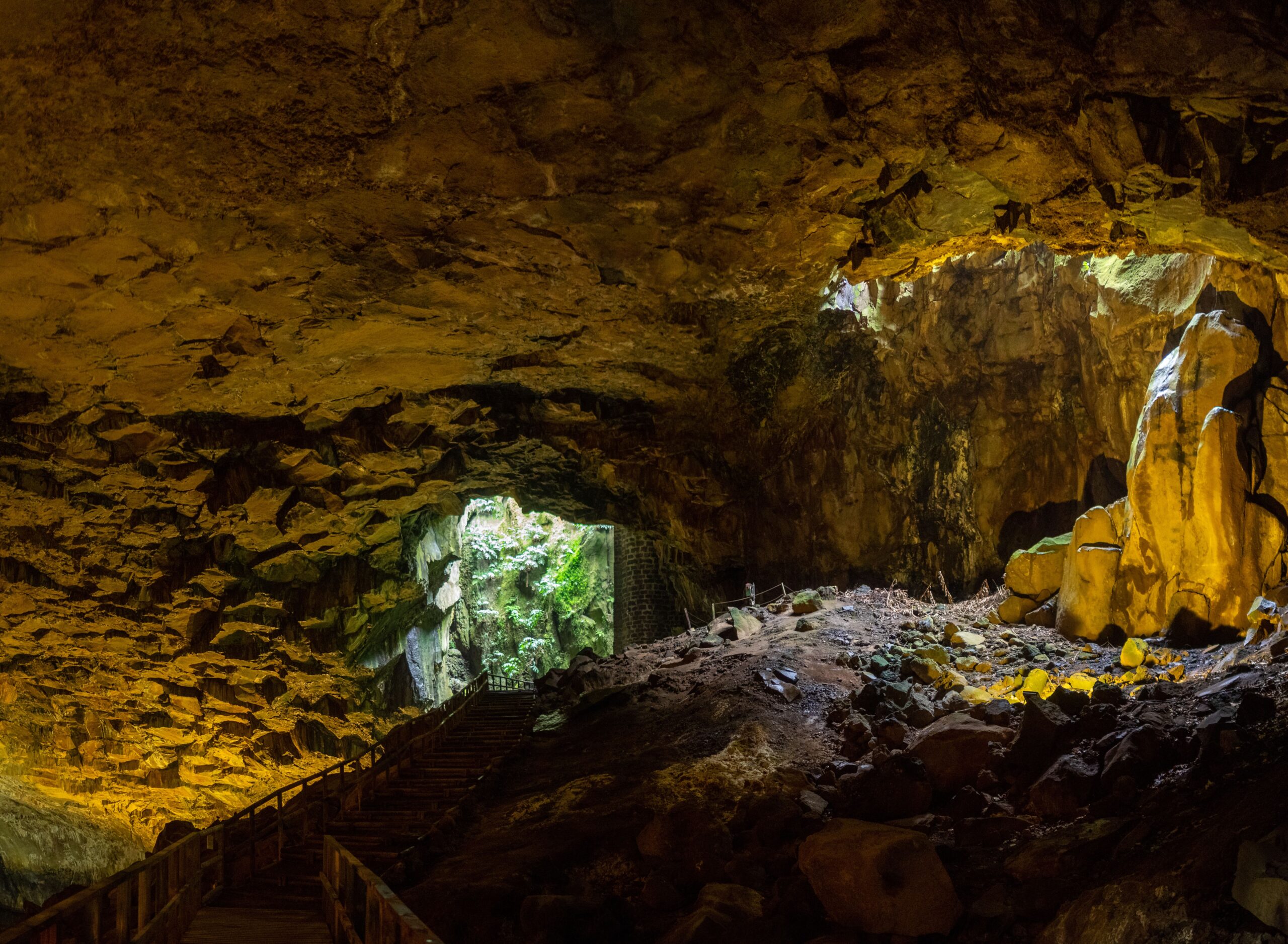
Furna do Enxofre and other Graciosa’s geological wonders
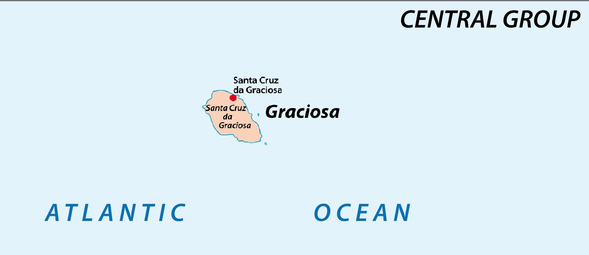
Map and population of Graciosa Island
Graciosa Island, part of the Azores archipelago, spans 24 square miles (61.66 km²) and boasts an elongated oval shape, measuring 8 miles (12.5 km) in length and 5 miles (8.5 km) at its widest point. Known as the “White Island” due to its low-lying topography and striking white volcanic features, Graciosa is the second smallest and least populous island in the Azores, with a population of approximately 4,000 residents. Most inhabitants are concentrated in Santa Cruz da Graciosa, the island’s main town, and Vila da Praia, known for its fishing traditions.
Furna do Enxofre Caldeira: one of many geological wonders
Graciosa’s diverse geography, from its flat plains to its towering cliffs, creates an ideal backdrop for nature enthusiasts. Hiking trails such as those leading to Pico Timão offer stunning views, while the bays and coves provide opportunities for kayaking and coastal exploration. The island’s volcanic heritage, including lava formations and caves like Furna do Enxofre, adds an adventurous element for visitors.
A unique geological formation
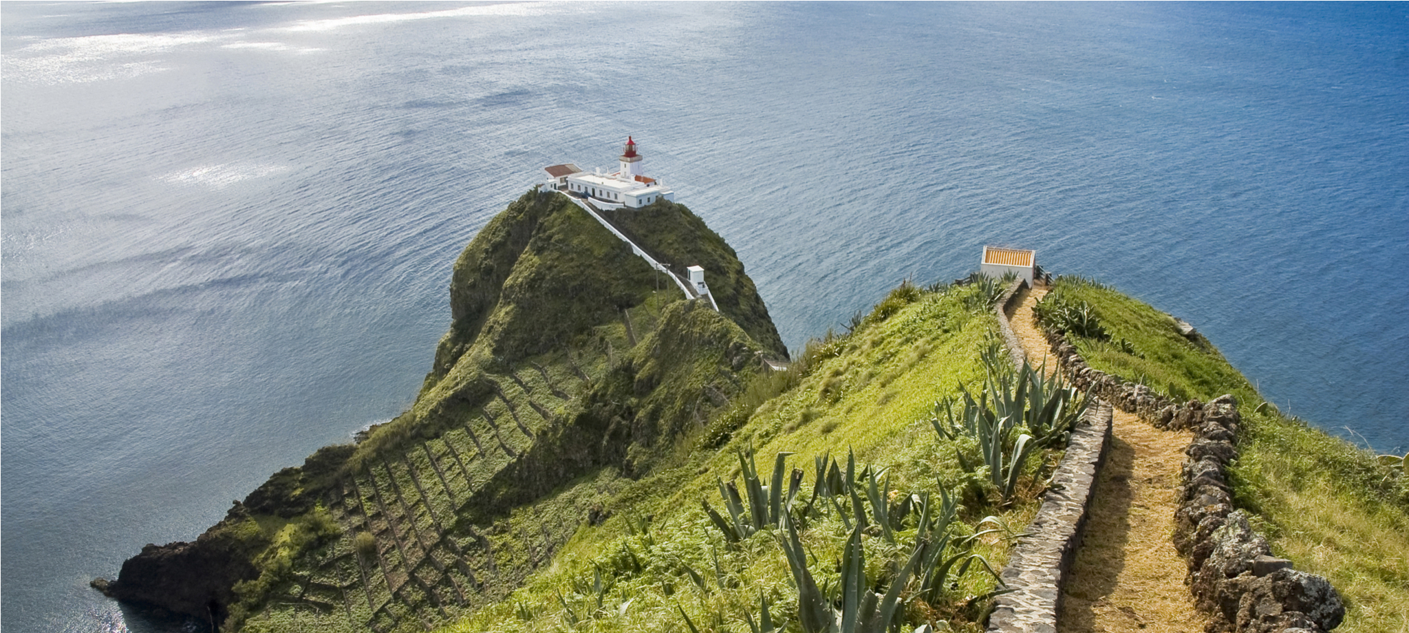
Graciosa lies within the northwest tectonic structure called the “Terceira Rift,” aligned with the southeast-to-northwest orientation of the Azores archipelago. This rift has shaped the island into its elongated oval form. The landscape is marked by contrasting features: low-lying plains dominate the northern and northeastern areas, while the terrain rises gradually to Pico Timão, the highest point on the island at 398 meters, offering panoramic views of the surrounding ocean and neighboring islands.
Coastal characteristics
The coastline is primarily rugged and rocky, with notable exceptions. In the northwest, Serra Branca features dramatic cliffs reaching up to 200 meters in height, showcasing the island’s volcanic origins. On the southeastern and southwestern shores, shallow bays provide natural harbors, supporting fishing activities in Vila da Praia and Folga. The northeast coast is dotted with smaller coves near Santa Cruz da Graciosa, which historically served as ports but are now mostly abandoned. Barra, once a hub for whaling and trade, has been transformed into a leisure and recreational zone.
By integrating its geological uniqueness with cultural and historical significance, Graciosa provides a serene escape where residents maintain a harmonious relationship with the land and sea.
Share the experience of discovering this incredible archipelago with your loved ones. Book a personalized group trip with Azores.com.