Geography of Terceira Island: volcanoes, map and population
Terceira Island, one of the 9 Azores’s islands, is defined by its unique volcanic landscape. The island’s terrain is the result of overlapping stratovolcanoes that formed along the Terceira Rift, a geologic fault line that extends across the region. This volcanic activity has shaped Terceira’s diverse topography, which includes lush forests, dramatic coastlines, and fascinating geological formations.
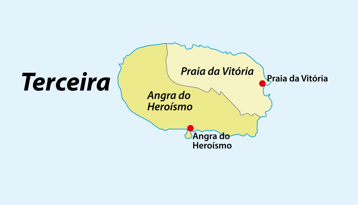
Terceira’s population and size
Terceira Island covers an area of approximately 402 square kilometers (155 square miles), making it the third-largest island in the Azores. It has a population of around 56,000 people, with the majority residing in the island’s two main cities: Angra do Heroísmo and Praia da Vitória. Angra do Heroísmo, a UNESCO World Heritage site, is the island’s historical and cultural center, while Praia da Vitória is known for its beautiful beach and modern amenities. The population density is relatively low, allowing for the preservation of natural landscapes and traditional Azorean villages scattered throughout the island.
Terceira island volcanoes: from Cinco Picos to Santa Barbara
Terceira’s volcanic origins can be traced to four main volcanic aggregates: Cinco Picos, Guilherme Moniz, Pico Alto, and Santa Barbara. The oldest, Cinco Picos, is believed to have formed around 300,000 years ago, creating a large caldera that is now covered in dense vegetation. Guilherme Moniz, located near the island’s center, is the largest caldera in the Azores, spanning nearly 15 kilometers. Pico Alto, with its rugged terrain, features several lava domes, while Santa Barbara, the highest point on the island at 1,021 meters (3,350 feet), provides panoramic views of the surrounding landscape. The volcanic activity that formed these complexes created a landscape characterized by craters, calderas, and rugged ridges, offering numerous opportunities for hiking and exploration.
At azores.com we have the perfect tour package for exploring these natural wonders. Check out the Self-Drive Terceira package and visit the island at your own pace!
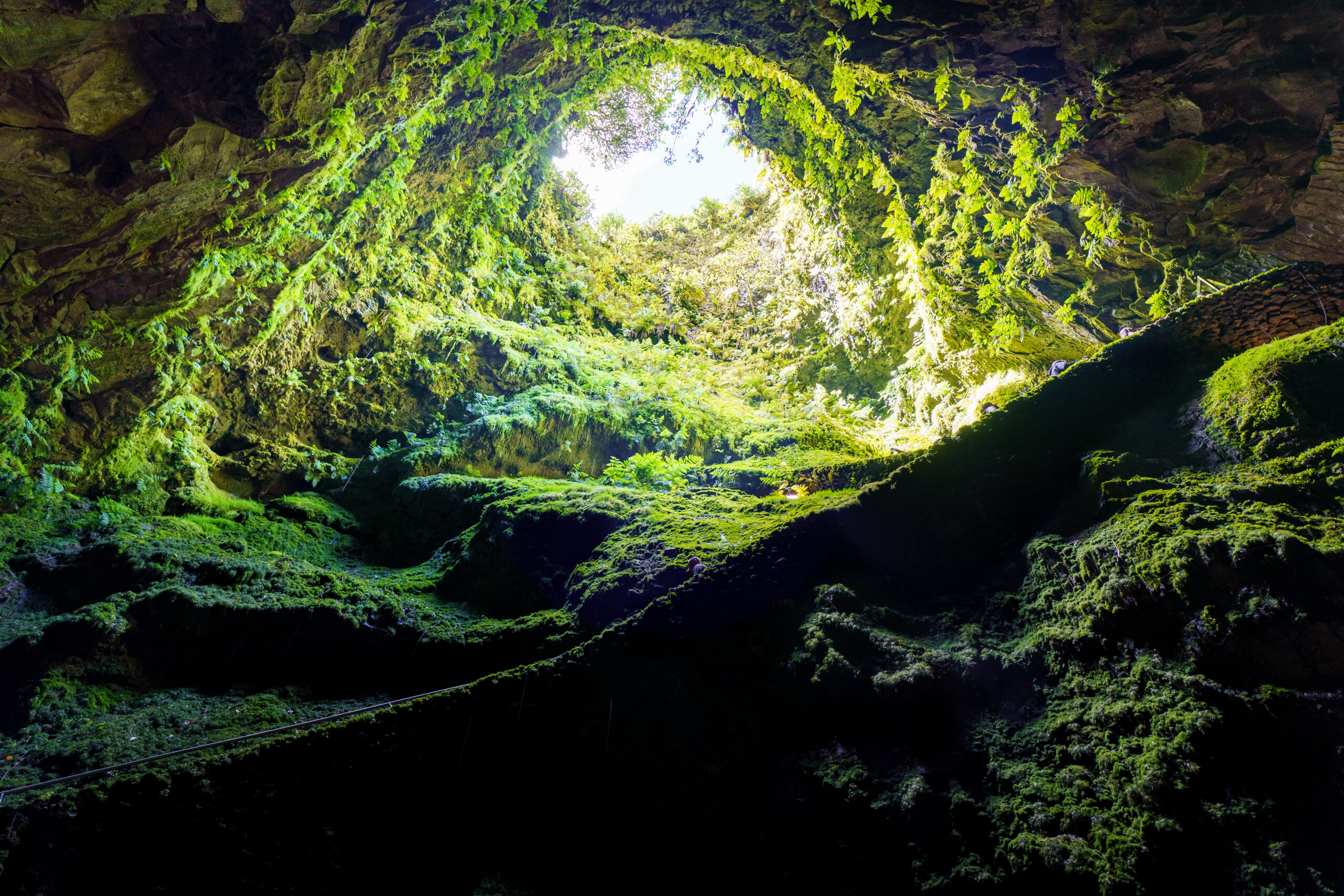
“Algar do Carvão”, “Gruta do Natal” and lava fields
One of Terceira’s most iconic geological attractions is the Algar do Carvão, a dormant volcanic cave located in the island’s center. Formed approximately 3,200 years ago, it features a large lava tube and a stunning underground chamber with stalactites and stalagmites made of silica. The cave’s interior is also home to a subterranean lake, which rises and falls with the season. Algar do Carvão is a popular spot for tourists and is one of the few places in the world where visitors can enter the magma chamber of a volcano.
Other volcanic caves on Terceira include “Gruta do Natal,” a lava tube formed during a basaltic eruption. The cave’s name is linked to a Christmas Mass held there in 1969. It offers an opportunity to explore the island’s volcanic past and observe unique geological formations up close.
The northern coast of the island is particularly notable for its “mistérios,” or lava fields, formed during volcanic eruptions in the 18th and 19th centuries. These fields, such as “Mistério da Praia” and “Mistério dos Negros,” present a striking landscape of black volcanic rock contrasting with the surrounding vegetation.
Lagoons, natural reserves and hot springs on Terceira
Terceira also features natural lagoons and protected areas that add to its geographic diversity. “Lagoa das Patas,” a small lagoon surrounded by lush vegetation, is a tranquil spot located in the forest of “Reserva Florestal de Recreio da Lagoa das Patas.” It serves as a habitat for various bird species, making it a peaceful location for birdwatching. Nearby, the “Reserva Natural da Serra de Santa Bárbara e dos Mistérios Negros” protects some of the island’s most pristine laurel forests and endemic flora. The reserve offers well-marked hiking trails, allowing visitors to experience Terceira’s natural beauty.
While Terceira’s geothermal activity is less pronounced than on some other Azorean islands, there are still areas where visitors can experience the heat of the Earth. “Furnas do Enxofre,” located near Algar do Carvão, is a fumarolic field where steam and sulfurous gases escape through cracks in the ground. The area is surrounded by rare plant species adapted to the geothermal environment, offering a unique look at the island’s volcanic nature.
Vegetation and climate: contrasts between east and west
The western part of Terceira Island is more verdant than the eastern side, primarily due to the prevailing westerly winds and higher levels of precipitation. The lush forests in the west include native species such as the Azorean laurel (“Laurus azorica”) and heather (“Erica azorica”). These forests are part of the island’s “Laurisilva” (laurel forest), a rare type of subtropical rainforest that once covered large parts of Europe. The hills near Santa Barbara are home to dense woodlands and a variety of endemic plant species.
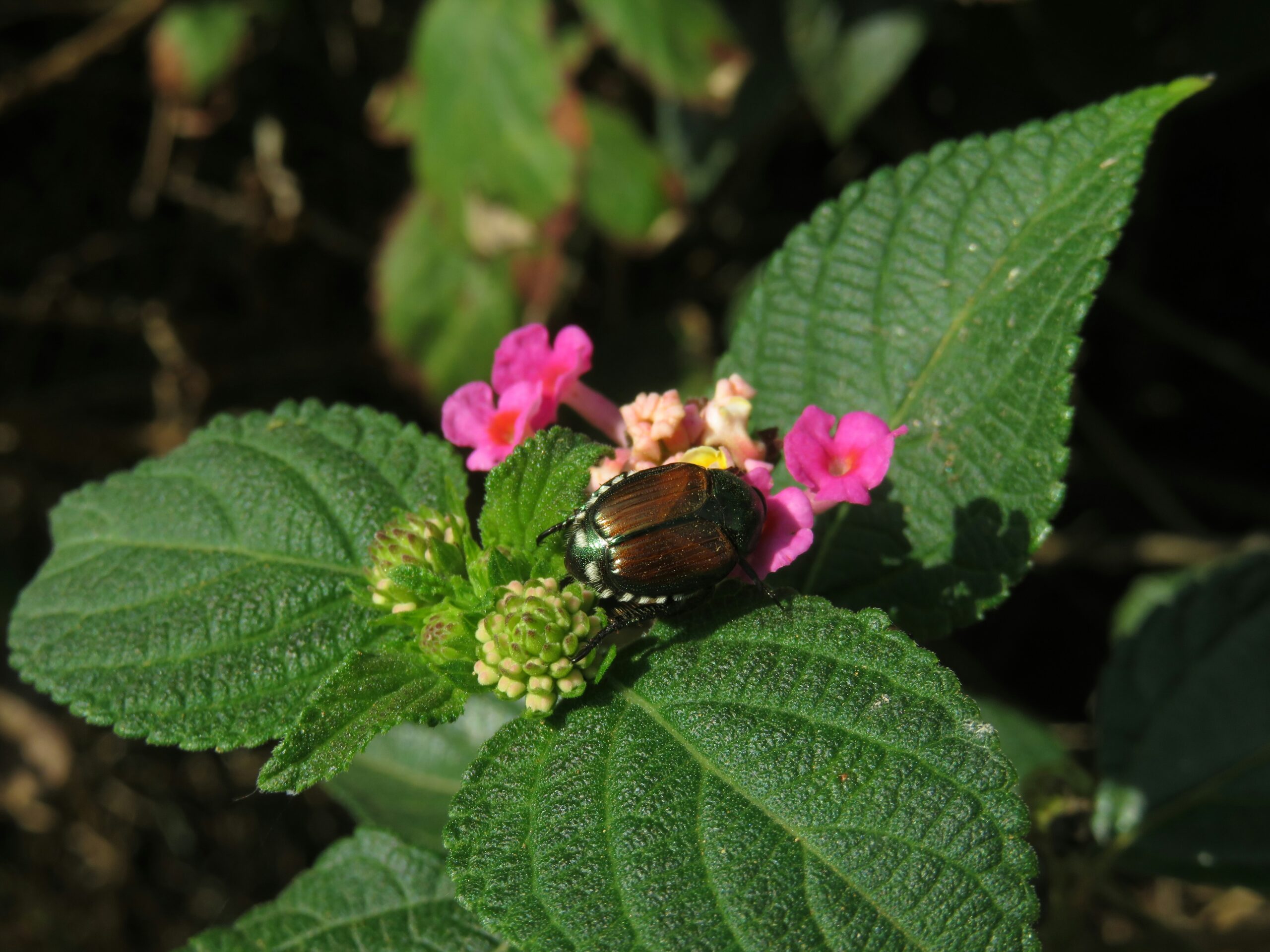
Photo by Joana Pires on Unsplash
In contrast, the eastern part of the island is drier and features more open landscapes. The plains of Achada, for instance, are less forested, creating a distinct visual contrast with the lush greenery to the west. The climate across Terceira is generally mild, with temperatures averaging between 12°C (54°F) in winter and 25°C (77°F) in summer, and rainfall is more frequent in the cooler months. Know more about Terceira’s weather!
Is the beauty of only Terceira not enough for you? Visit more than one island on the same trip! Check out our Multi-Island Private Guided Tours and see what suits you best.