Graciosa Geography: Volcanoes, Landscape & Travel Guide
Low relief, high geodiversity
Geography of Graciosa Island
Graciosa is a compact, relatively low-lying volcanic island in the Central Group, distinguished by its Caldeira, lava caves, pale ridges, rocky coast and protected offshore islets.
Island measurements
Graciosa Geography at a Glance
Map and setting
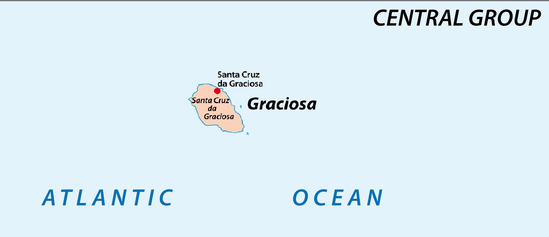
Where Is Graciosa?
Graciosa is the northernmost island of the Azores Central Group. Its elongated form reflects regional tectonic structures associated with the Terceira Rift. It lies west of Terceira and north of São Jorge, with Pico and Faial visible from higher ground in clear weather.
Volcanic landforms
Geological Features That Shape Graciosa
Caldeira da Graciosa
A broad volcanic depression dominates the southeast and contains the island’s most important cave system.
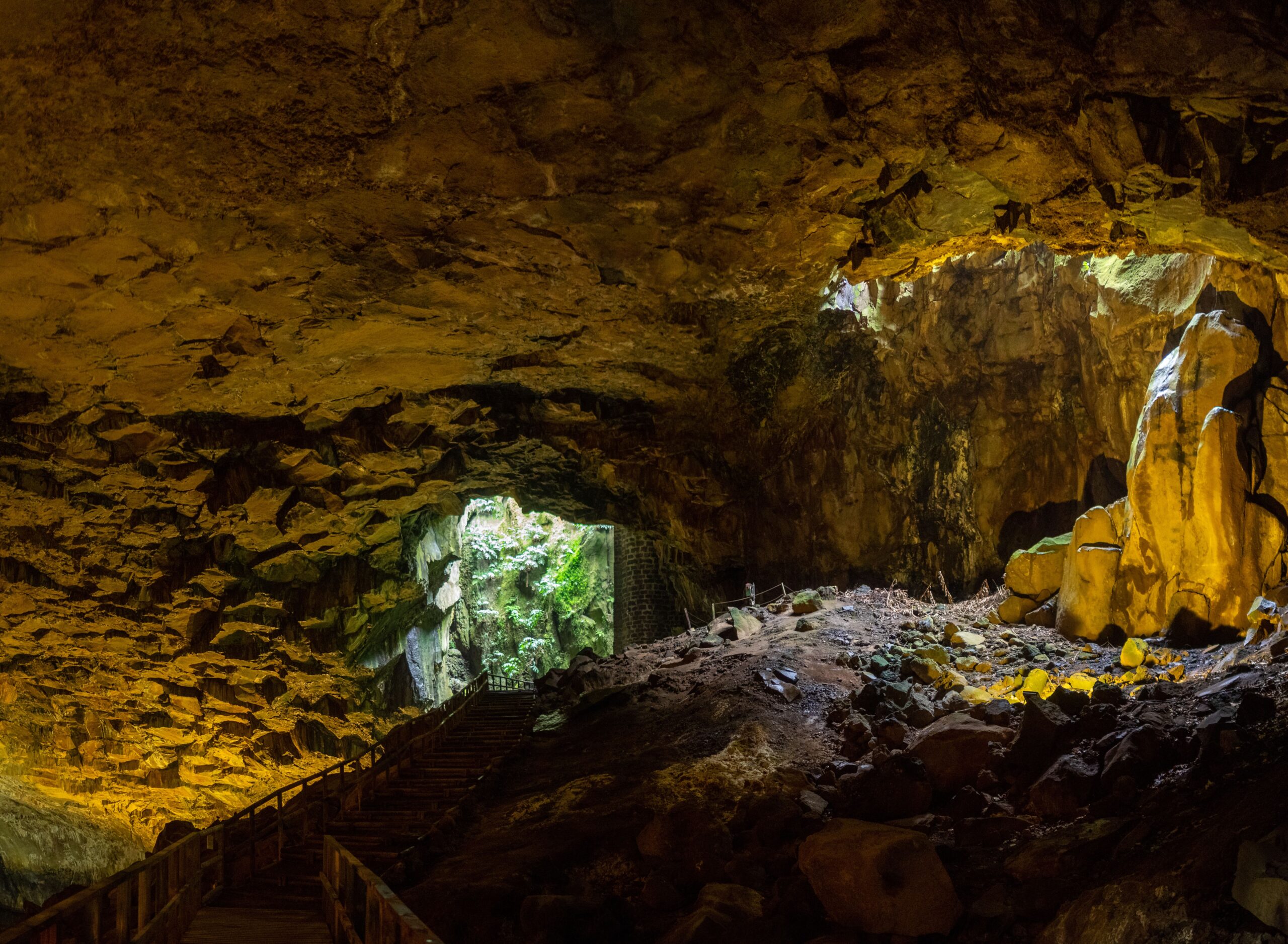
Furna do Enxofre
The immense cave contains a sulfurous lake and a volcanic dome recognized by UNESCO and Azorean geological authorities.
Serra Branca
The pale western ridge rises above steep coastal cliffs and contributes to the White Island identity.
Northern plains
The north and northeast are relatively level, supporting settlement, pasture and cultivated fields.
Southern uplands
Ground rises toward the Caldeira and the island’s highest terrain, including the areas known as Timão and Facho.
Offshore islets
Ilhéu da Praia and Ilhéu de Baixo are protected volcanic islets important for seabirds and marine habitats.
Coast and communities
Bays, Ports and Four Parishes
Santa Cruz
The principal town and parish occupies the northeast, with the historic center, airport area and former port zones around Barra.
São Mateus (Praia)
The eastern fishing community has a sheltered port, small beach, windmills and views toward Ilhéu da Praia.
Guadalupe
The inland-western parish is closely tied to pasture, farming and the pale landscape around Serra Branca.
Luz
The southern parish includes Carapacho, the thermal coast and access toward the Caldeira uplands.
Serra Branca cliffs
The pale western ridge ends in dramatic coastal cliffs that reach roughly 200 meters in places. Stay back from unstable and windy edges.
Praia and Folga bays
Shallower southeast and southwest inlets form natural harbors that supported fishing and maritime access where much of the remaining coast is rocky.
Barra and Santa Cruz coves
Smaller northern coves served trade and former whaling activity; Barra now also supports leisure use.
Protected landscape
A UNESCO Biosphere Reserve
Graciosa entered UNESCO’s World Network of Biosphere Reserves in 2007. Its relatively dry climate limits some habitats, but the island has exceptional geological diversity and important coastal and marine ecosystems. Protection depends on responsible visits to caves, islets, wetlands and geological sites.
Do not enter closed caves
Gas, unstable ground and conservation restrictions make unauthorized access unsafe.
Protect seabird areas
Observe Ilhéu da Praia and Ilhéu de Baixo only in ways permitted by current conservation rules.
Keep maps uncropped
Use the complete island map when planning routes so the Caldeira, ports and parish relationships remain clear.
Plan by landform
Practical Graciosa Geography Tips
Use current measurements
Published area figures vary slightly around 60.7–61.7 km² because of mapping methods. This guide uses about 60.7 km² for current headline context.
Treat summit heights as approximate
Published elevation figures vary slightly by reference; modern island summaries place the highest terrain at about 405 meters.
Do not enter unsigned cavities
Lava tubes can contain gas, loose rock, darkness and protected habitat. Use authorized access and qualified guidance.
Respect cliff distance
Serra Branca and other coastal escarpments can be unstable and windy. Remain behind barriers and away from eroded edges.
Protect island hydrology
Do not contaminate cave lakes, ponds, coastal pools or drainage channels with soap, food or waste.
Plan ports separately
Praia da Graciosa is the principal ferry port; Santa Cruz, Barra and Folga have different historical and present-day functions.
Questions travelers ask
Graciosa FAQ
How large is Graciosa?
It covers about 60.7 square kilometers, making it the second-smallest island in the Azores.
Is Graciosa mountainous?
It is the flattest Azores island. The highest terrain reaches only about 405 meters, although volcanic ridges and coastal cliffs remain prominent.
Why is it called the White Island?
The name is linked to pale volcanic formations and place names such as Serra Branca, Barro Branco and Pedras Brancas, reinforced by whitewashed settlements.
How many parishes are on Graciosa?
Four: Santa Cruz, São Mateus (Praia), Guadalupe and Luz.
What is the highest point on Graciosa?
Modern island summaries place the highest terrain near 405 meters; published figures can vary slightly by reference point and dataset.
Build a practical island stay
Plan Your Graciosa Vacation
Azores.com can coordinate flights, lodging, transportation and enough time to explore this quieter Central Group island.