Santa Maria Geography: Volcanoes, Landscape & Travel Guide
The Azores’ oldest island, with fossils, red clay and contrasting halves
Santa Maria Island Geography
Santa Maria covers about 97.1 square kilometers and is the southernmost and easternmost Azores island, with an older geological record and a striking divide between dry west and humid east.
Island profile
Position, Size and Population
Map and setting
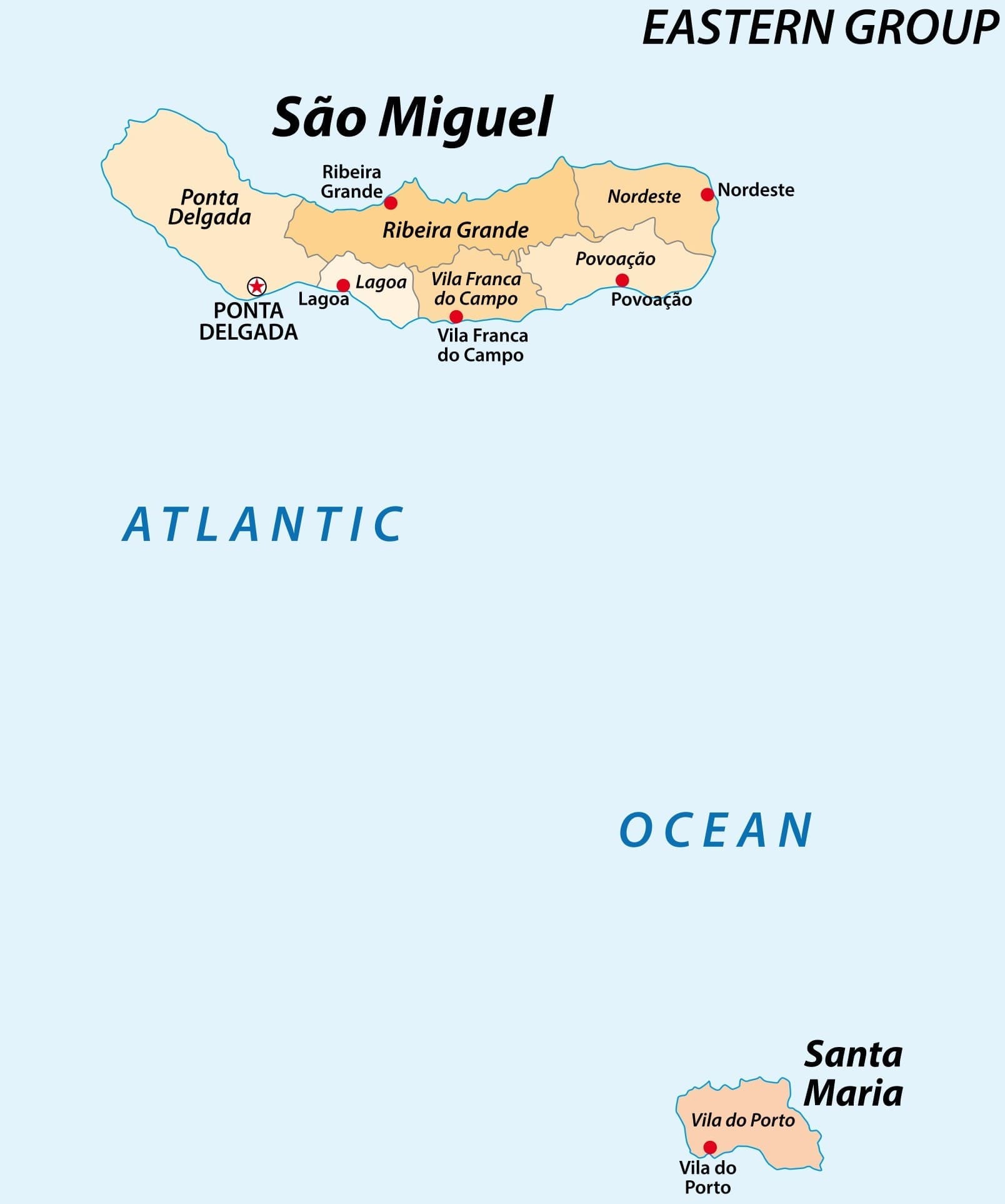
The Eastern Group’s Southern Island
Santa Maria belongs to the Eastern Group with São Miguel and lies roughly 55 miles away. It is the Azores’ southernmost and easternmost inhabited island, about 760 nautical miles from Lisbon and roughly 2,110 miles from New York. Its compact scale hides steep local relief and marked climate differences.
Five parishes
Population and Settlement Pattern
Vila do Porto
The municipal seat, airport side and principal service center had 3,017 residents in the 2021 census.
São Pedro
The west-central parish had 813 residents in 2021 and includes agricultural land and connections toward Anjos and Pico Alto.
Almagreira
The south-central parish, associated with Praia Formosa, had 617 residents in the 2021 census.
Santo Espírito
The greener eastern parish had 597 residents in 2021 and connects inland settlement with Maia and surrounding countryside.
Santa Bárbara
The northeastern parish had 370 residents in 2021 and includes access toward São Lourenço and rural valleys.
2025 island estimate
The current island-level estimate is 5,544. Parish figures above remain useful historical census detail and should not be added as if they were 2025 estimates.
Ancient geology
Basalt, Limestone, Fossils and Red Earth
Oldest Azores foundation
Santa Maria began forming roughly eight million years ago, giving erosion and sedimentation far more time than on younger islands.
Basaltic volcanism
Lava flows, cones and volcanic structures form the foundation, even where soil, pasture or marine sediments hide the basalt.
Marine sediments
Periods of subsidence and changing sea level left sedimentary deposits that are unusual within the archipelago.
Pleistocene fossils
Prainha and Lagoinhas preserve fossil evidence of former marine environments. Fossils must remain in place unless collected under lawful scientific authority.
Ponta do Castelo
Exposures around this eastern headland help reveal layered volcanic and marine history, with some deposits roughly five million years old.
Lime industry
Limestone and other calcareous deposits supported a nineteenth-century lime industry, linking Santa Maria’s unusual geology with local building and labor history.
Barreiro da Faneca
Iron-rich weathered material creates the famous red landscape. Stay on legal access and do not remove clay or enlarge erosion scars.
Relief and climate
Why East and West Feel Different
Flatter western half
The airport, Vila do Porto and Anjos occupy lower, drier terrain where fields can turn yellow earlier in the season.
Mountainous east
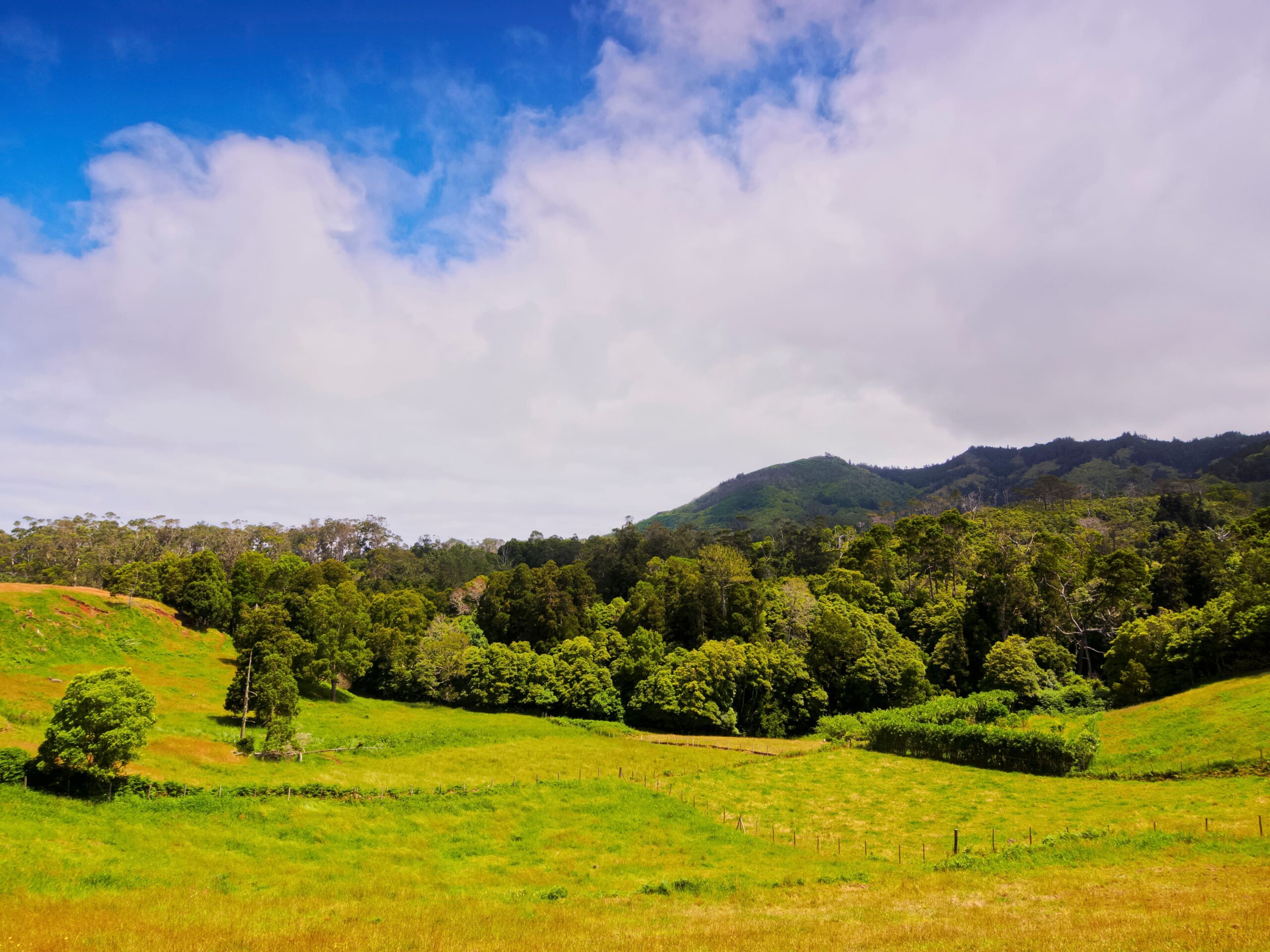
Deeper valleys, cliffs and higher rainfall support greener slopes around Santo Espírito, Maia and São Lourenço.
Pico Alto
At 586.84 meters, the island summit supports laurel-forest habitat and marks a wetter, cooler dividing massif.
Protected summit
The Pico Alto protected area covers about 121 hectares and contains native and endemic vegetation deserving strict low-impact use.
Warm maritime climate
Ocean influence prevents major temperature extremes, while lower elevation and southern position contribute to Santa Maria’s relatively sunny reputation.
Agricultural landscape
Pasture, grain fields, vineyards and orchards reflect soil, slope, water and settlement history rather than an untouched wilderness.
Plan well
Practical Santa Maria Geography Tips
Use the map as orientation
A short straight-line distance can involve steep roads, blind bends or a long descent. Route by legal road and actual access.
Keep the map uncropped
The island map is displayed with object-fit:contain so coastline, labels and orientation remain visible.
Visit geology responsibly
Do not collect fossils, clay, lava or minerals. Use designated paths and a qualified guide where sites are fragile or access is unclear.
Expect summit fog
If Pico Alto is clouded, move to a coastal or heritage stop and return later instead of waiting on an exposed road.
Protect farm access
Do not block gates or narrow roads, and close any gate crossed by an official trail.
Distinguish data years
Use the 2025 total population for the current headline and retain 2021 parish counts only with their census date.
Questions travelers ask
Santa Maria Geography FAQ
How large is Santa Maria Island?
Current regional information gives an area of about 97.1 square kilometers and a longest diagonal of about 15.5 kilometers.
How high is Pico Alto?
The protected summit reaches 586.84 meters, normally rounded to 587 meters.
Why is Santa Maria geologically unusual?
It is the oldest Azores island, about eight million years old, and preserves marine sedimentary layers and fossils uncommon on younger islands.
How many people live on Santa Maria?
The official 2025 island estimate is 5,544 residents. The detailed parish counts in this guide come from the 2021 census.
Why is the east greener than the west?
The higher eastern massif receives more cloud and rain, while the lower west is generally warmer, drier and flatter.
Build a practical island stay
Plan Your Santa Maria Vacation
Azores.com can coordinate flights, lodging, transportation, activities and enough flexible island time to explore comfortably.