Corvo Geography: Volcanoes, Landscape & Travel Guide
One volcano at the edge of the Atlantic
Geography of Corvo Island
Corvo is a compact volcanic island in the Western Group, built around the Caldeirão central volcano and edged by high sea cliffs except for the southern lava platform that supports Vila do Corvo.
Island measurements
Corvo Geography at a Glance
Map and setting
Where Is Corvo?
Corvo is the smallest and northernmost island in the Azores and, with Flores, forms the Western Group. It lies west of the Mid-Atlantic Ridge on the North American Plate. The island is roughly oval, elongated north to south, with almost the entire population concentrated in Vila do Corvo.

Central volcano
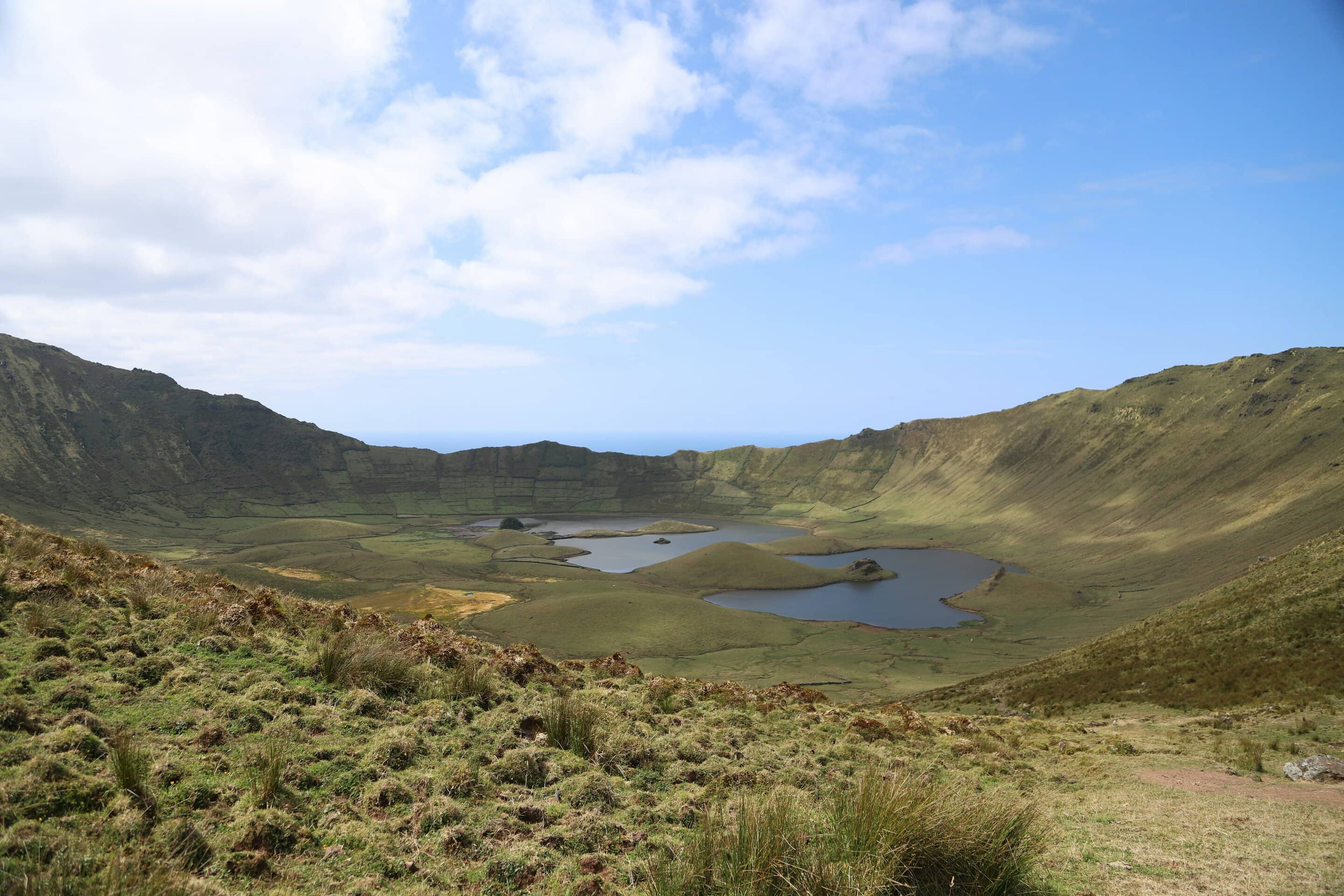
Caldeirão: Corvo’s Defining Landform
Collapse caldera
The summit depression measures about 2.3 by 1.9 kilometers and reaches approximately 305 meters deep.
Lakes and wetlands
Rainwater, Sphagnum peat, marshy ground and two principal lakes create a sensitive hydrological system on the crater floor.
Small volcanic cones
Scoria and spatter cones rise inside the caldera; local tradition imagines the lakes and islets as a miniature representation of the nine Azores islands.
Highest rim
The Estreitinho area reaches about 720 meters; Morro dos Homens is also widely used for the island’s highest upland.
Protected habitat
The caldera belongs to a protected landscape with rare endemic flora and fauna, wetland habitat and grazing animals.
Weather exposure
The crater rim frequently catches cloud, wind and rain, creating conditions very different from the southern village.
Coast and lava platform
Cliffs, Dikes and Vila do Corvo
Vila do Corvo lava delta
The only large low, flat area was built by lava flows from Morro da Fonte and supports the village, airport and harbor.
Ponta do Marco
Marine erosion exposes a complex sequence of volcanic layers and basaltic dikes along the island’s northwestern cliffs.
Cavaleiro and Marco
Named basalt formations in the southwest reflect erosion of Corvo’s volcanic structure and remain distinctive coastal landmarks.
Coroínha and Pingas
These southern geosites combine a volcanic cone, eroded cliff and views across the channel toward Flores.
Praia da Areia
A small accumulation of dark volcanic sand forms the island’s principal beach near the settlement.
Steep northern and western coast
High cliffs, small coves and an energetic ocean limit access and explain the importance of the southern harbor and airport.
Community and conservation
One Municipality, No Civil Parishes
The municipality of Corvo covers the entire island and has no civil parishes. All residents live in or around Vila do Corvo. The 2021 Census recorded 384 people, underlining the exceptionally small scale of the community.
UNESCO Biosphere Reserve
Corvo joined the World Network of Biosphere Reserves in 2007, protecting the whole island and a large surrounding marine area.
Exceptional endemism
UNESCO identifies a high density of rare, threatened and endemic species relative to Corvo’s very small land area.
Leave sensitive areas intact
Do not remove plants, rocks or biological material, and follow access rules around wetlands and bird habitats.
Plan by terrain
Practical Corvo Geography Tips
Use the current area figure
Corvo covers about 17.1 km²; rounded figures can vary slightly by dataset and publication.
Correct the summit name
Current references place the island’s highest terrain in the Estreitinho / Morro dos Homens area at roughly 718–720 meters.
Measure the crater correctly
Caldeirão measures about 2.3 by 1.9 kilometers across, with figures varying slightly by measurement method.
Protect peat and lakes
Stay on the official crater route and avoid trampling saturated vegetation, contaminating water or disturbing grazing animals.
Respect cliff exposure
Cavaleiro, Marco, Coroínha and Pingas occupy windy, eroded terrain. Use lawful viewpoints and official trails.
Keep the map uncropped
The complete Corvo map uses object-fit:contain so the Caldeirão, southern lava platform, village and coast remain visible.
Questions travelers ask
Corvo FAQ
How large is Corvo?
It covers about 17.1 square kilometers and measures roughly 6.24 kilometers long by 3.99 kilometers wide.
How deep is Caldeirão?
The collapse caldera is about 305 meters deep and approximately 2.3 by 1.9 kilometers across.
What is Corvo’s highest point?
Authoritative geographic sources place the highest terrain near 720 meters in the Estreitinho area; Morro dos Homens is the widely used summit name.
Where does everyone live?
The entire population is concentrated in Vila do Corvo, the island’s only settlement and municipality center.
Is Corvo on the North American Plate?
Yes. Corvo and Flores lie west of the Mid-Atlantic Ridge on the North American Plate and together form the Azores Western Group.
Build a practical Western Group stay
Plan Your Corvo Vacation
Azores.com can coordinate flights, lodging, Flores connections and enough flexibility for Atlantic weather.