São Miguel Geography: Volcanoes, Lakes & Island Regions
Volcanoes, lakes, coast and six municipalities
Understanding São Miguel Geography
São Miguel is a long volcanic island built from major volcanic systems, crater lakes, high eastern mountains, fertile lowlands and a deeply indented Atlantic coast.
Island dimensions
How Big Is São Miguel?
Three useful planning zones
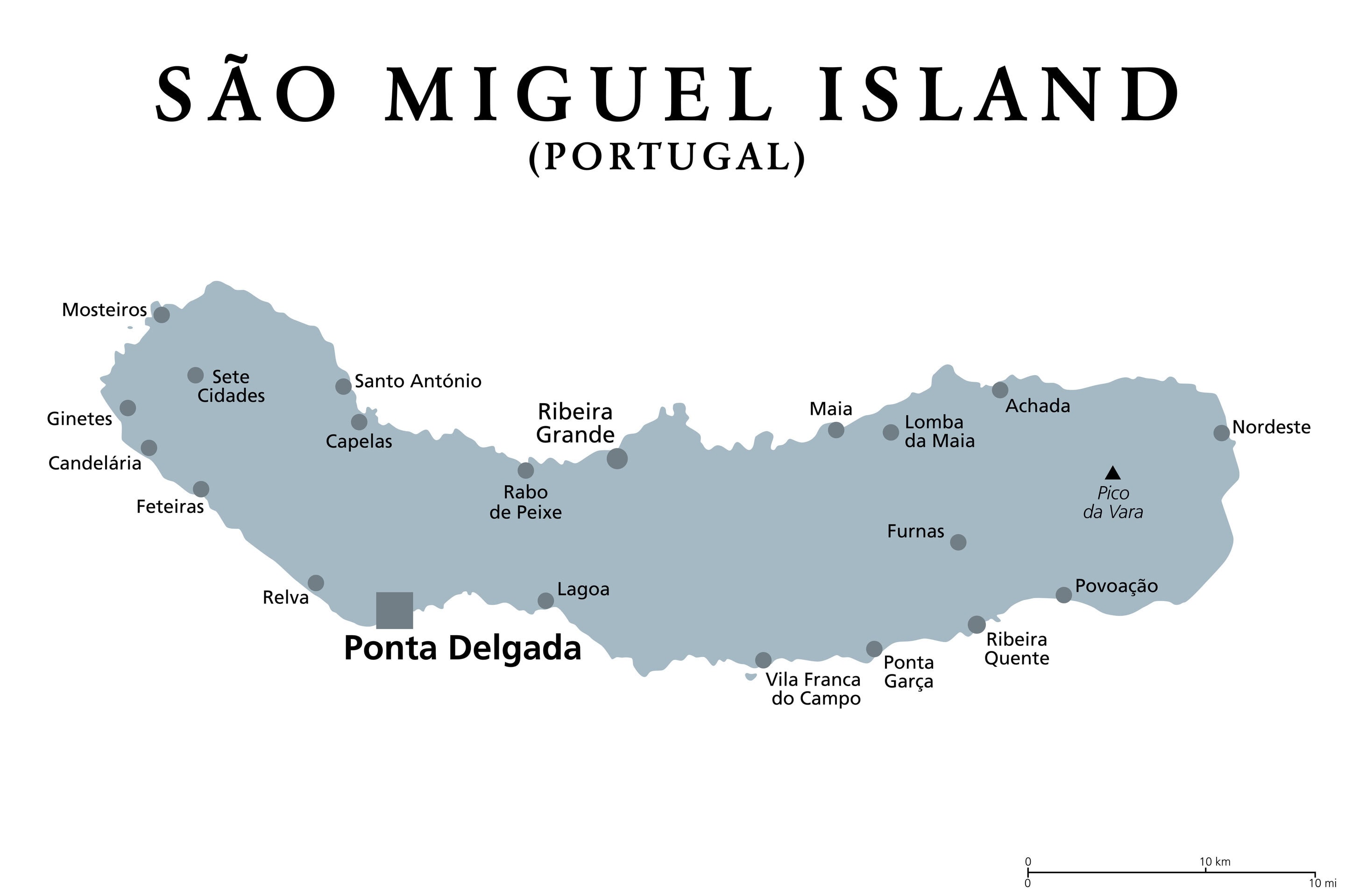
West, Center and East
Western São Miguel
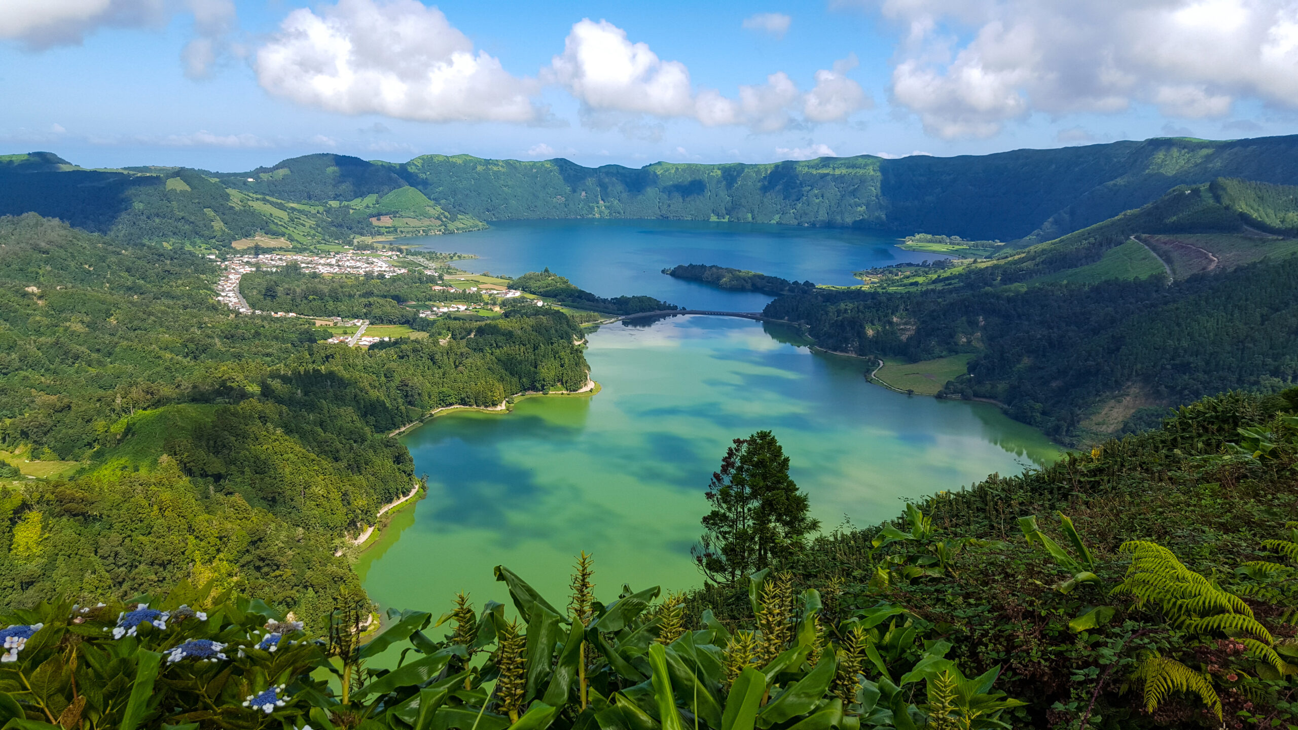
Sete Cidades dominates the west with crater-rim viewpoints, linked lakes, Mosteiros and a dramatic lava coast.
Central São Miguel
Ponta Delgada, Lagoa and Ribeira Grande frame the Água de Pau massif, Lagoa do Fogo and Caldeira Velha.
Eastern São Miguel
Furnas, Povoação, Nordeste, Serra da Tronqueira and Pico da Vara form a greener, steeper and more mountainous region.

Volcanic landscape
The Systems That Built the Island
Sete Cidades volcanic complex
The western caldera contains Lagoa Azul, Lagoa Verde and smaller lakes and cones. Its rim produces Vista do Rei, Boca do Inferno and other celebrated viewpoints.
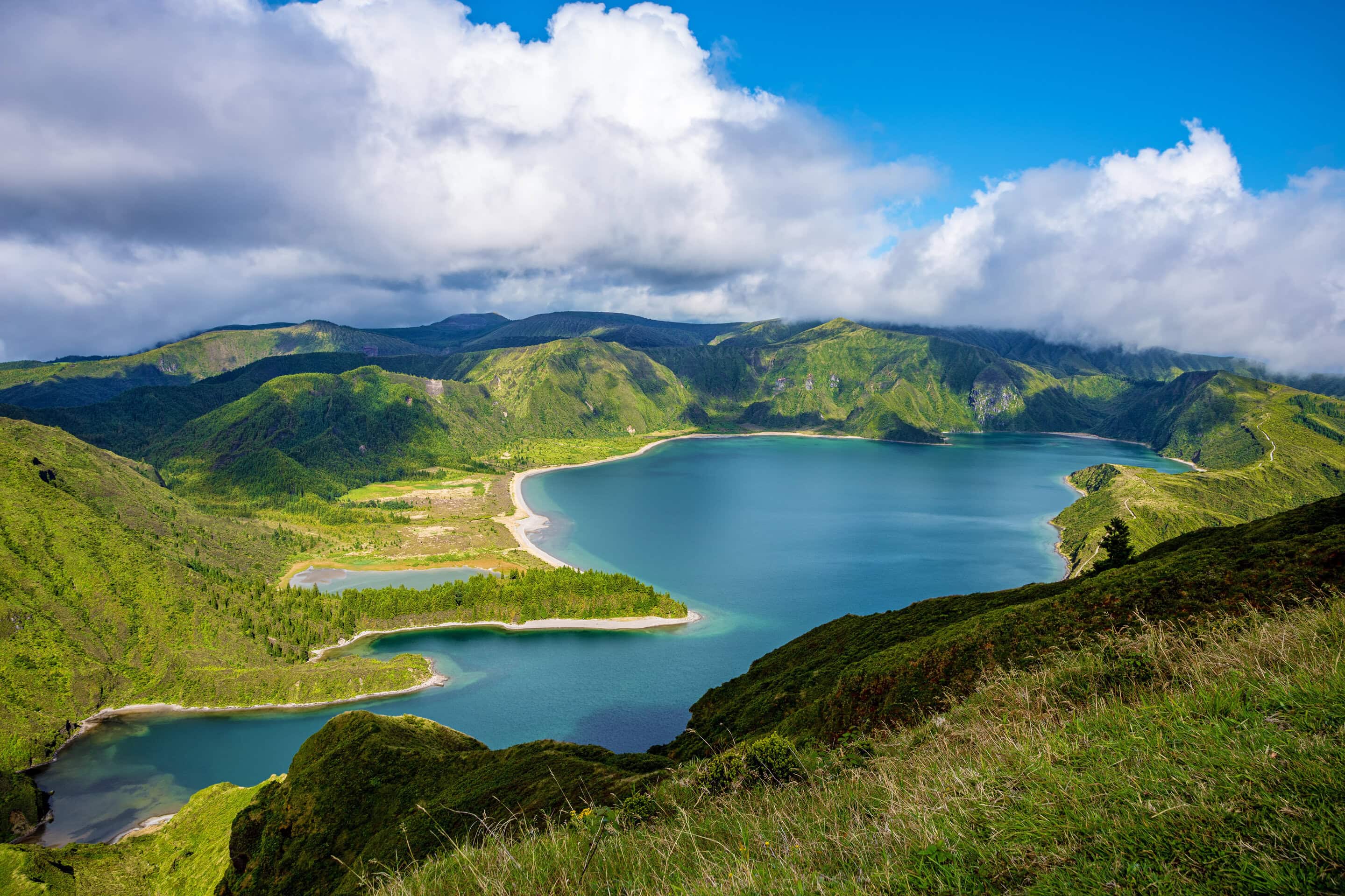
Fogo / Água de Pau massif
The central volcanic system contains Lagoa do Fogo at high elevation and geothermal areas including Caldeira Velha on its northern slope.
Furnas volcanic system
Furnas combines a crater lake, fumaroles, hot springs and gas-rich mineral waters that remain visible in daily life and tourism.
Povoação caldera
The southeast settlement lies within an older volcanic structure whose valleys and seven ridges shape local roads and views.
Picos fissural zone
Numerous smaller cones and lava flows link the western and central systems, creating rolling pasture and lower interior terrain.
Tronqueira and Pico da Vara
The island’s highest and wettest terrain protects native forest, peat-forming habitat and the endemic Azores bullfinch, or priolo.
Settlements
São Miguel’s Six Municipalities
Ponta Delgada
Southwest: main city, airport gateway, historic center, port and largest concentration of visitor services.
Ribeira Grande
North and center: north-coast city, Santa Bárbara Beach and access toward Lagoa do Fogo, Salto do Cabrito and tea country.
Lagoa
South-center: coastal municipality between Ponta Delgada and the island’s eastern half, including natural pools and Caloura nearby.
Vila Franca do Campo
South-center-east: early capital, historic town, pottery traditions and the departure point for the protected islet.
Povoação
Southeast: early settlement area encompassing Furnas, valleys, coastal villages and the island’s geothermal heart.
Nordeste
East: mountainous scenery, forests, the Pico da Vara area, waterfalls and landscaped coastal viewpoints.
Why geography matters
Practical Route and Weather Effects
A direct circuit of the main island roads may take roughly three to four hours without meaningful stops, but that figure is not a sightseeing plan. São Miguel rewards several days because lakes, geothermal areas, towns, trailheads and viewpoints branch away from the fastest route. Its 133,295 residents recorded in the 2021 Census make it the archipelago’s population center, and Ponta Delgada is its principal political, economic and cultural hub.
Group sights by region
Plan separate west, central/north and east days rather than repeatedly crossing the island.
Expect local weather differences
Ridges and elevation can leave crater rims cloudy while coastal areas remain clear.
Do not trust drive time alone
Scenic roads, viewpoints, village traffic and elevation changes add meaningful time to each route.
Protect high-elevation plans
Pico da Vara and Lagoa do Fogo require suitable visibility, trail or road status and weather.
Questions travelers ask
São Miguel Geography FAQ
How large is São Miguel?
São Miguel covers about 745 square kilometers and stretches roughly 65 kilometers east to west, making it the largest island in the Azores.
What is the highest point?
Pico da Vara, in the eastern part of the island, reaches approximately 1,105 meters above sea level.
Is Ponta Delgada the capital of the Azores?
It is the largest city and seat of the regional presidency. The autonomous region’s institutions are distributed among several islands.
Why are there so many lakes and hot springs?
São Miguel is volcanic. Calderas, crater lakes, fumaroles, mineral springs and geothermal waters are surface expressions of the systems that built it.
Can weather differ across the island?
Yes. Atlantic exposure, ridges and elevation can create large differences in cloud, wind and rain over short distances.
Build a practical island stay
Plan Your São Miguel Vacation
Azores.com can coordinate lodging, transportation, guided experiences and enough flexibility for São Miguel’s changeable Atlantic weather.