São Jorge Geography: Volcanoes, Landscape & Travel Guide
A narrow volcanic ridge, immense cliffs and more than seventy fajãs
São Jorge Island Geography
São Jorge is one of the Azores’ most distinctive landforms: a 54-kilometer volcanic ridge only 6.9 kilometers wide, with high cliffs interrupted by lava and landslide fajãs.
Island profile
Position, Size and Population
Read the island
Map and Central Group Setting
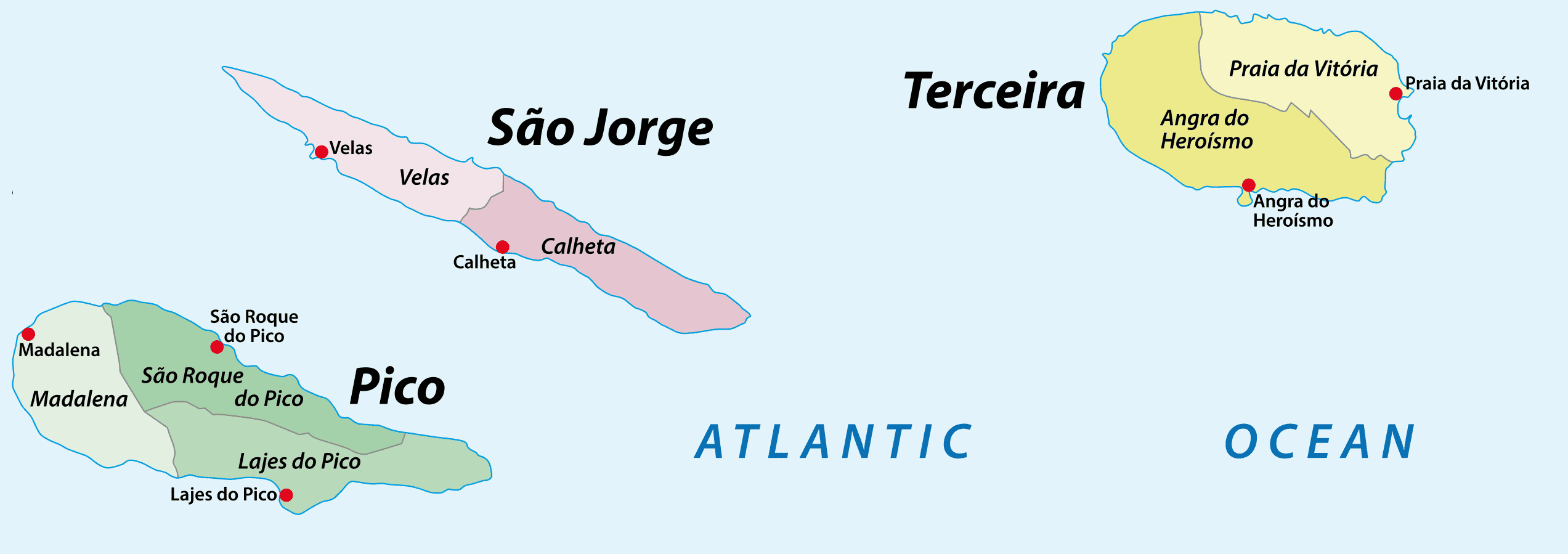
São Jorge occupies the middle of the five Central Group islands. It is approximately 40 kilometers south of Graciosa, 20 kilometers north of Pico, 60 kilometers west of Terceira and 30 kilometers east of Faial. Together with Pico and Faial it forms the Triangle Islands, linked by current ferry services.
The island’s west-northwest to east-southeast alignment resembles a long ship or dragon. Velas occupies a protected south-coast setting near the airport and principal ferry port; Calheta serves the southeast; Topo anchors the eastern end; Rosais extends toward the northwest. A continuous ridge separates north- and south-facing slopes, making short straight-line distances misleading.
Volcanic foundation
Fissures, Cones and Historic Eruptions
Island age
São Jorge began forming about 1.32 million years ago through basaltic fissure volcanism, younger in the west and older toward Topo.
Central alignment
Roughly 150 eruptive centers—mostly scoria cones, spatter cones and fissures—follow the island’s dominant volcanic and tectonic direction.
Pico da Esperança
The 1,053-meter summit formed about 5,500 years ago and sits within a high conservation area rich in lagoons, peatlands and endemic plants.
Algar do Montoso
Morro Pelado contains the Azores’ deepest known volcanic pit, approximately 140 meters, with specialized cave habitat. It is not an independent visitor cave.
Historic eruptions
Recorded subaerial eruptions occurred in 1580 and 1808. A submarine eruption developed southwest of Rosais in 1964.
Earthquake landscape
The severe 1757 earthquake caused landslides and substantially enlarged some debris fajãs, including Caldeira de Santo Cristo.
Coast-defining landforms
How São Jorge’s Fajãs Formed
Approximately 74 fajãs
Current regional geology identifies more than seven dozen coastal flatlands.
Lava fajãs
Some formed when basaltic lava reached the sea and built new low land, often with rocky shores and younger volcanic surfaces.
Landslide fajãs
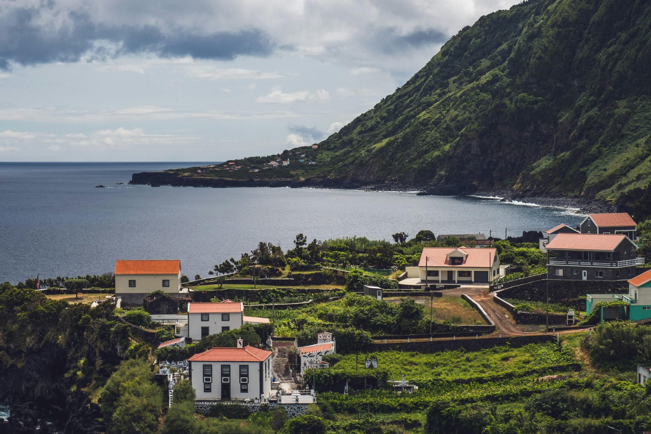
Others formed when cliff collapse, slides and erosion deposited debris at the coast. These are especially distinctive in the older east.
Settlement and farming
Fertile soil, water, mild microclimates and sea access supported homes, orchards, vineyards, coffee, livestock and small harbors.
Wetland habitats
Lagoons at Santo Cristo and Cubres support aquatic and migratory birdlife and require protection from pollution and disturbance.
High cliffs
Some coastal escarpments reach roughly 600 meters, producing waterfalls, ravines and difficult access between plateau and sea.
Protected island
Biosphere Reserve and Living Landscapes
UNESCO designation
The Fajãs de São Jorge Biosphere Reserve joined the World Network in 2016 and covers the entire island plus sea to three nautical miles offshore.
Reserve area
The combined terrestrial and marine designation totals about 98,113.97 hectares and recognizes natural, geological and cultural values.
Nature Park
Created in 2011, the island park contains multiple protected landscapes, habitats, resource areas, Ramsar wetlands and priority geosites.
Endemic uplands
The central plateau contains peatlands, lagoons and rare plants such as Azorean juniper, endemic heather and the very rare Azorean butterfly orchid.
Coastal wildlife
Seabirds, shorebirds, marine fish and invertebrates occupy cliffs, islets, lagoons and surrounding sea. Observe without feeding or crowding.
Working landscape
Pasture and dairy farming remain essential. Drive slowly around cattle movement and do not cross fields without a legal path.
Plan well
Practical São Jorge Geography Tips
Plan by ridge and coast
A fajã directly below a viewpoint may require a long road or walking descent. Check the actual legal access.
Expect plateau fog
Move to a coastal activity if Pico da Esperança is clouded and return later instead of stopping in unsafe roadside positions.
Protect lagoons
Do not swim, wash equipment, feed wildlife or enter shellfish areas where current rules prohibit it.
Respect landslide risk
Avoid cliff bases and closed paths after heavy rain or seismic activity; local restrictions take priority.
Leave geology in place
Lava, minerals, cave material and fossils are not souvenirs.
Use current figures
Official sources differ slightly on area and length. This guide uses current Natural Park figures of 243.8 km² and 54 km.
Questions travelers ask
São Jorge Geography FAQ
How large is São Jorge Island?
Current Natural Park information gives an area of about 243.8 square kilometers, a length of 54 kilometers and a maximum width of 6.9 kilometers.
How many fajãs does São Jorge have?
Regional geodiversity information identifies approximately 74, formed either by lava entering the sea or debris accumulating after landslides.
How high is Pico da Esperança?
Pico da Esperança reaches 1,053 meters and is the highest point on São Jorge.
Is São Jorge volcanic?
Yes. It is a basaltic fissure-volcanic island with about 150 eruptive centers and recorded eruptions in 1580, 1808 and offshore in 1964.
When did São Jorge become a Biosphere Reserve?
UNESCO added the Fajãs de São Jorge Biosphere Reserve in 2016, covering the island and an adjacent marine area.
Build a practical island stay
Plan Your São Jorge Vacation
Azores.com can coordinate lodging, transport, official trails and enough flexibility for São Jorge’s ridge, fajãs and Atlantic weather.